


How Do Geostationary and Geosynchronous Satellites Differ?
Geostationary and geosynchronous satellites are essential concepts in satellite physics, with direct implications in communication systems, weather forecasting, and navigation. Understanding their orbits and functions is fundamental for topics in gravitation and motion of satellites, especially for JEE Main Physics.

Definitions of Geostationary and Geosynchronous Satellites
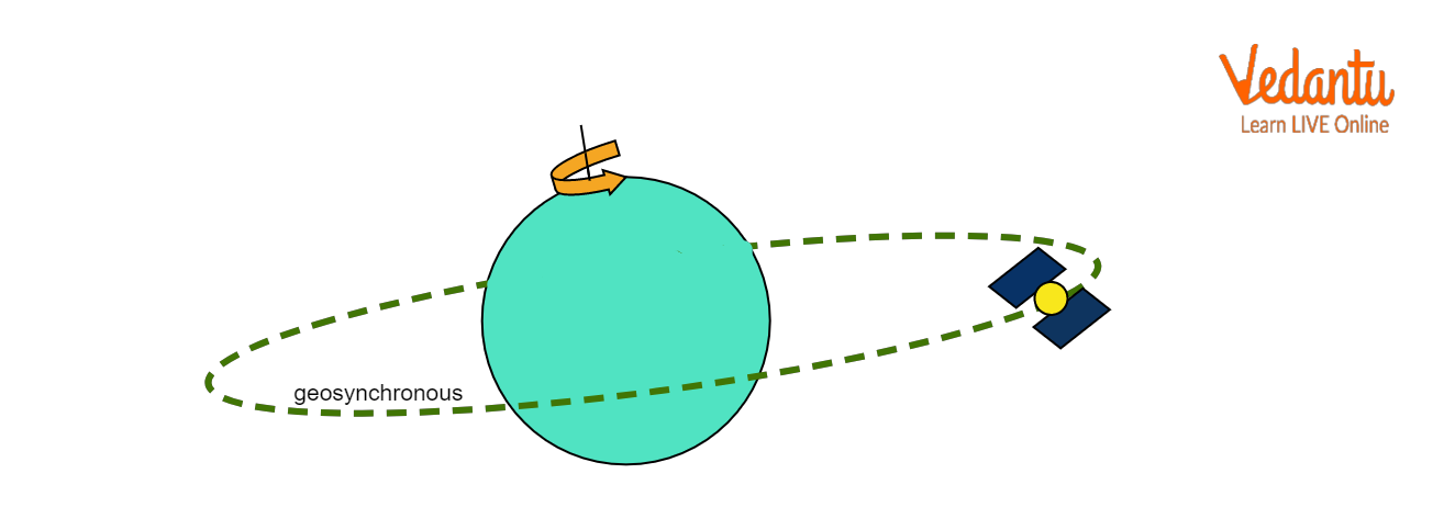
A geostationary satellite orbits Earth in the equatorial plane with an orbital period equal to Earth's rotational period. It remains fixed above the same geographical location on the equator. Its orbit is circular with zero inclination.
A geosynchronous satellite has an orbital period equal to one sidereal day (approximately 24 hours) but may have an inclined or elliptical orbit. It traces a regular ground pattern but does not remain stationary over a single point, except when its orbit is equatorial and circular.
Both types of satellites utilize a balance of gravitational and centrifugal forces to maintain stable orbits as described in the study of satellite motion. For an overview of relevant gravitational principles, refer to Gravitation Explained.
Key Differences Between Geostationary and Geosynchronous Satellites
While all geostationary satellites are geosynchronous, not all geosynchronous satellites are geostationary. The distinction depends on the orbit's inclination, shape, and position relative to the equator. The following table presents the primary differences relevant for the JEE Main syllabus.
| Geostationary Satellite | Geosynchronous Satellite |
|---|---|
| Circular, equatorial (0° inclination) | Usually inclined/elliptical, not always equatorial |
| Remains fixed above one equatorial point | Appears to oscillate over Earth in 24h |
| Orbital period = 24 hours | Orbital period = 24 hours |
| Altitude ≈ 35,786 km | Altitude often 35,786 km, can vary |
| Used for TV, communication, weather | Used for navigation, regional coverage |
Geostationary satellites are always positioned above the equator. Geosynchronous satellites may have orbits inclined to the equator, causing their ground path to trace a figure-eight (analemma) pattern over the course of a day.
For a detailed treatment of orbital motion, consult Motion of Satellites of Earth.
Orbital Conditions and Derivation for Satellite Period and Height
The altitude for geostationary and geosynchronous orbits is derived by equating the centripetal force with the gravitational force acting on the satellite. Both forces must balance to sustain a stable orbit.
The gravitational force is $F_g = \dfrac{GMm}{r^2}$, and the centripetal force required is $F_c = \dfrac{mv^2}{r}$. Equating both gives $v = \sqrt{\dfrac{GM}{r}}$.
The orbital period $T$ is related by $v = \dfrac{2\pi r}{T}$, so substituting for $v$:
$\dfrac{2\pi r}{T} = \sqrt{\dfrac{GM}{r}}$
Squaring and rearranging, $T^2 = \dfrac{4\pi^2 r^3}{GM}$.
For a geostationary or geosynchronous satellite, $T = 24 \text{ hours} = 86,400 \text{ s}$; $M = 5.972 \times 10^{24} \text{ kg}$; $G = 6.67 \times 10^{-11}\ \text{N m}^2 \text{kg}^{-2}$. Earth's radius $R \approx 6.378 \times 10^6 \text{ m}$.
Solving for orbital radius $r$ gives $r = 42,164\, \text{km}$, and the required altitude, $h = r - R \approx 35,786\, \text{km}$ above Earth's surface. This altitude ensures synchronization with Earth's rotation.
Only a satellite with a zero inclination, circular orbit (equatorial plane), and this specific period appears stationary and is truly geostationary. Inclined orbits at this altitude are geosynchronous but not geostationary.
Ground Track and Visibility
A geostationary satellite's ground track remains fixed over a single location on the equator. In contrast, a geosynchronous satellite not in the equatorial plane exhibits apparent daily movement, producing an analemma-shaped track when observed from the ground.
Coverage from geostationary satellites is limited to the equatorial and nearby regions. The satellite cannot service polar areas due to the geometry of the orbit above the equator.
Applications of Geostationary and Geosynchronous Satellites
Geostationary satellites are widely used for continuous telecommunication, live television broadcasting, weather monitoring, and disaster warning services, due to their fixed coverage area.
Geosynchronous satellites with inclined orbits serve applications requiring periodic coverage of specific regions, such as navigation systems or targeted weather observation.
- Geostationary orbit used in DTH television
- Continuous observation for meteorology
- Stable satellite communication links
- Navigation with regional geosynchronous systems
- Monitoring natural disasters in fixed sectors
For more on relevant physics and practice questions, refer to Gravitation Important Questions.
Key Points and Exam Considerations
Common exam errors include confusing the terms geostationary and geosynchronous, or misidentifying their orbital paths. Always verify if the orbit is circular, zero inclination, and above the equator to classify as geostationary.
- All geostationary satellites are geosynchronous
- Not all geosynchronous satellites are geostationary
- Period is always one sidereal day (24 hours)
- Altitude for both is approximately 35,786 km
- Orbital velocity for geostationary satellite is around 3.07 km/s
- Geostationary satellites cover one-third of Earth's surface
Satellites in low Earth orbit, such as those in Starlink's network, do not have a period of 24 hours and thus are neither geostationary nor geosynchronous. These orbits allow global coverage but with rapidly changing ground tracks.
Example Calculation: Required Altitude for Geostationary Orbit
To calculate the altitude for a geostationary satellite, use the formula $T^2 = \dfrac{4\pi^2 r^3}{GM}$. Substitute $T = 86,400\, \text{s}$, $G = 6.67 \times 10^{-11}\ \text{N m}^2\text{kg}^{-2}$, and $M = 5.972 \times 10^{24}\ \text{kg}$.
Solving gives $r = 42,164\ \text{km}$, resulting in an altitude $h = 42,164 - 6,378 = 35,786\ \text{km}$. This altitude ensures the satellite matches Earth’s rotational period and remains fixed to an observer on the surface.
For further derivations and formulas involving satellite motion, visit Orbital Velocity and Satellites.
Comparison with Other Satellite Orbits
Geostationary and geosynchronous satellites are different from polar or sun-synchronous satellites. Polar satellites pass over the poles and provide complete Earth coverage but are not stationary relative to any ground point.
These alternative orbits are often used for global mapping, environmental studies, and applications requiring repeated coverage of the entire planet at different timings or lighting conditions. Detailed study of types of orbits is useful for comparative questions in Physics exams.
Summary of Geostationary and Geosynchronous Satellite Concepts
A clear conceptual understanding of geostationary and geosynchronous satellites is essential for solving JEE-level problems on gravitation and satellite motion. Focus on orbital characteristics, period, altitude, and typical applications for accurate distinction.
Relate these concepts with key topics such as satellite velocity, energy in orbits, and application-based questions for comprehensive physics preparation. Further conceptual clarity can be achieved from Understanding Kinematics.


FAQs on Understanding Geostationary and Geosynchronous Satellites
1. What is a geostationary satellite?
A geostationary satellite is a satellite that orbits the Earth at the equator with a period matching the Earth's rotation, appearing stationary over one point.
- Remains above the same location on the equator
- Completes one orbit every 24 hours
- Used for telecommunication, weather monitoring, and TV broadcasting
2. What is the difference between geostationary and geosynchronous satellites?
Geostationary and geosynchronous satellites both have orbital periods equal to Earth's rotation, but differ in their positions relative to Earth.
- Geostationary satellites: Stay fixed above one point on the equator and have zero inclination.
- Geosynchronous satellites: Can have inclined orbits and appear to move in a figure-eight over the Earth.
3. What are the uses of geostationary satellites?
Geostationary satellites are widely used for efficient, constant communication and monitoring.
- Television broadcasting
- Telephone and internet relay
- Weather forecasting and observation
- Military communication
4. Explain the key features of geostationary satellites.
Key features of geostationary satellites include their unique orbit and operational characteristics.
- Orbit above Earth's equator at ~35,786 km altitude
- 24-hour orbital period synchronized with Earth's rotation
- Appear fixed relative to a point on Earth
- Support global communication networks
5. What are the advantages and disadvantages of geostationary satellites?
Geostationary satellites offer easy coverage but also face some limitations.
- Advantages: Continuous coverage, ideal for TV and communication, fixed location simplifies tracking
- Disadvantages: High launch altitude costs, not suitable for polar regions, signal delay (~0.25 second), limited capacity for crowded orbital slots
6. What is a geosynchronous satellite?
A geosynchronous satellite is a satellite whose orbit has a period equal to Earth's rotation (24 hours), but it may not always be above the equator.
- Can have inclined or elliptical orbits
- Appears to trace a path over Earth during a day
- All geostationary satellites are geosynchronous, but not all geosynchronous satellites are geostationary
7. Why are geostationary satellites placed at 35,786 km altitude?
Geostationary satellites are positioned at an altitude of about 35,786 km so their orbital period matches Earth’s rotation.
- This altitude ensures a 24-hour orbit
- Satellite remains fixed over a single equatorial point
- Allows for constant communication with ground stations
8. How does a geostationary satellite remain stationary relative to the Earth?
A geostationary satellite appears stationary because its orbital speed matches Earth's rotation.
- Orbits in the equatorial plane
- Alt: 35,786 km, which gives a 24-hour period
- Revolves in the same direction as Earth's rotation (west to east)
9. What are some real-life examples of geostationary satellites?
Real-life examples of geostationary satellites include prominent communication and weather satellites.
- INSAT series (India) for telecommunication and meteorology
- GOES satellites (USA) for weather observation
- Direct-to-home TV satellites
10. What is the orbital speed of a geostationary satellite?
The orbital speed of a geostationary satellite is about 3.07 km/s.
- This speed keeps the satellite synchronised with Earth's rotation
- Ensures the satellite completes one full orbit every 24 hours
- Critical for stable satellite operations